Bristol Maps and Orientation
(Bristol, England, UK)
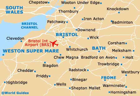
Located in South-West England and within the county of the same name, Bristol is a large and spreading city, with a population now not far from half a million residents. Bristol is well connected to many major cities and tourist destinations by both road and rail, such as
Bath (21 km / 13 miles - south-east),
Cardiff (72 km / 45 miles - west),
London (169 / 105 miles - east),
Oxford (137 km / 85 miles - north-east) and
Weston Super Mare (39 km / 24 miles - south-west).
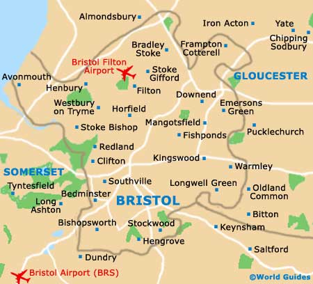
The city centre continues to evolve and reinvent itself, with the recent addition of the Cabot Circus mall making this area all the more appealing to shoppers. Much of central Bristol is full pedestrianised and filled with large 'big-name' department stores, particularly in the Broadmead area and along Broad Street, with the Hippodrome theatre, Colston Hall and floating harbour all being just a short walk away.
Maps and Orientation of the City
The suburb of Clifton and its famous suspension bridge lies on the north-western side of Bristol and is linked by regular city buses. Near to Clifton is the Bristol Zoo attraction and a further collection of shops, along Whiteladies Road. The railway station (Bristol Temple Meads) is situated around 1.5 km / 1 mile to the south-east of the city centre and is a good source of maps, as is the Tourist Information Office (TIC) at the Harbourside's Wildscreen Walk.
Map of the United Kingdom

Map of Bristol County
Map of Bristol